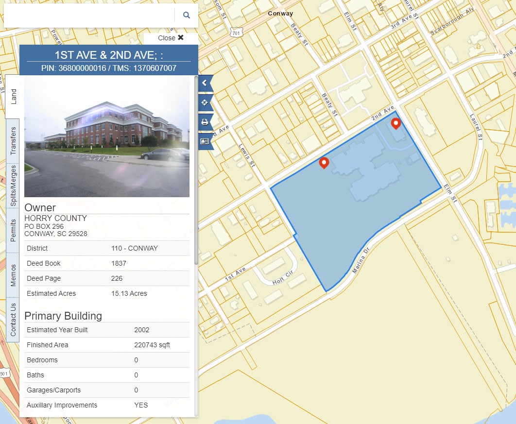
Land Records
The Land Record data and mapping application represent the parcel fabric as used for taxing purposes and not for survey purposes.
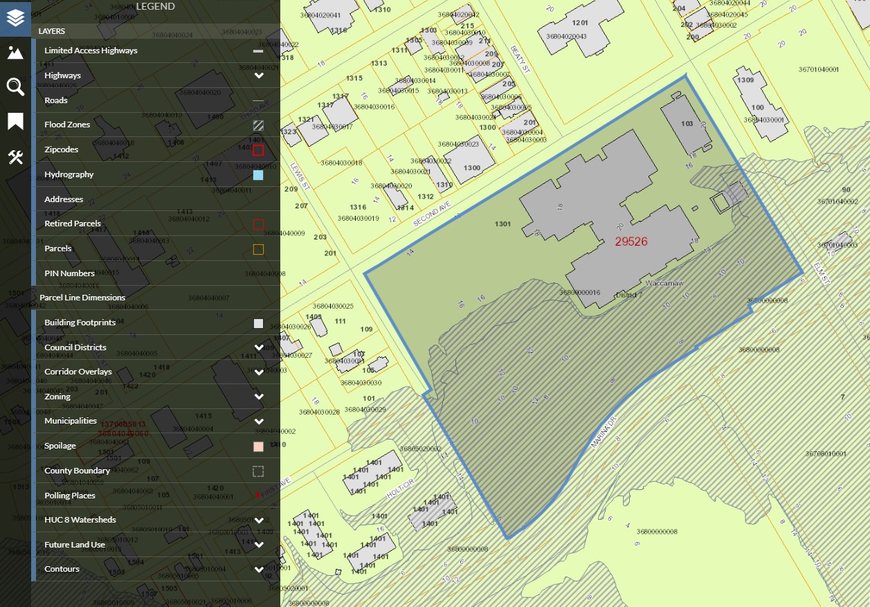
GIS Application
The GIS data and mapping application represent the parcel fabric as used for taxing purposes and not for survey purposes.
Map Your Move
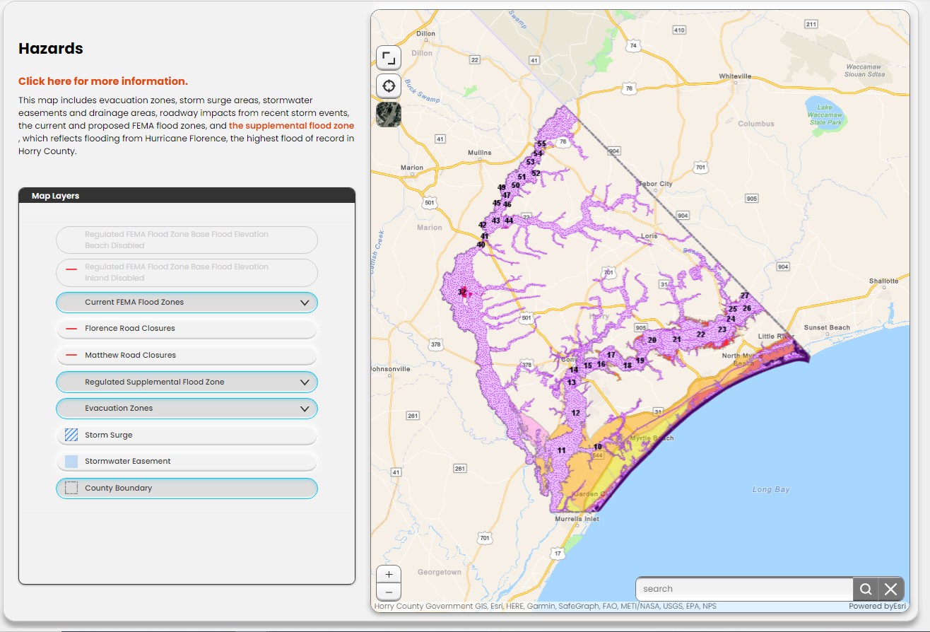
These tools are designed to help you learn more about the areas and neighborhoods in unincorporated Horry County. Whether you are looking to move, checking out a rental, or discovering more about where you live now, the maps on this page will provide you with valuable local information. It is important to be aware of local hazards unique to our area like hurricanes, flooding and wildfires.
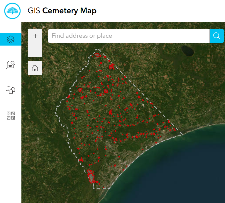
Cemetery Search
Started in 2007, the Horry County Cemetery Project is Horry County’s attempt to inventory, map, and preserve every gravesite in every historic cemetery in the County, even those that may have been lost for decades. The project attempts to record all names, dates of birth and death, symbols, and condition from every gravesite in every historic cemetery in Horry County, as well as digitally map the cemeteries using GIS tools. Unmarked graves are also found and permanently marked using ground penetrating radar. The project was undertaken to: (1) protect historic properties at the local level; (2) protect historic properties from encroachment and growth pressures; (3) create greater interest in historic preservation; and, (4) create the necessary framework for local level protection.